At last I was entering Bolivia. I had dreamed of visiting this country since my first travelling experience in Europe when I was 18. I heard from other travellers that it was ridiculously cheap and packed with adventure opurtunities with three tall mountain ranges. Hosting the highest capital city in the world La Paz at 3500m and of course the highest lake of any such size in the world Lago Titicaca at 38oom. Acclimatizing is unavoidable if you wish to travel the country at all as it is the highest on average of any country in the Americas.
We entered from Peru on the shores of Lake Titicaca set in the barren slopes of the altiplano(high plane). The altitude is indeed tiring at times you simply can´t catch your breath even when relaxing. Luckily we had been at around 3000m in Cuzco, Peru for almost 2 weeks and we had plenty of coca leaves tea which slighly numbs your senses and helps tolerate the thin air. We arrived in a scenic but
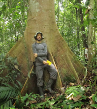
 slighly touristy town of Cocacabana where we settled for a couple days and did some hiking in the surrounding mountains. It happened to be Halloween that night which is celebrated much differently in Latin America but there was a Halloween party in a local gringo bar so we dressed up and went out. None of us had costumes of course until I realized that I had a perfect costume and so I spilled the contents of my backpack and suited up in full mountaneering attire minus of course ice axe and crampons( not really appropriate for the bar). Needless to say I got some funny reactions walking down the street of this tiny Bolivian town.
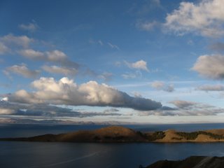
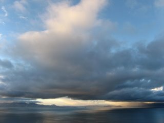
The sunsets from our hotel terrace were phenomenal due mostly to the clarity of the high altitude air. Sam arrived two days later and we all boarded a boat bound to La Isla Del Sol just off the shore from us.
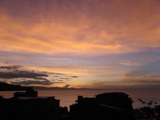
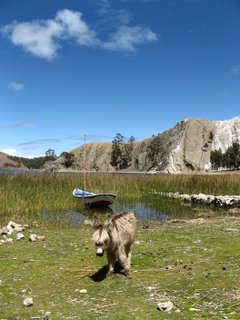
The island was pretty touristy but due to the low season it retained its ancient charm. One story of Incan creation is that the first humans arrived from the sun onto this island. It seemed very little had changed in a long time and the towns dotting the island were rich in charm. It was November 1st, El Dia de Los Muertos (The day of The Dead) so me and Sam night hiked over to a near town from where we were staying to visit the cemetary and catch a glimpse of what this night meant in Latin America. Family members gathered around graves of their deceased loved ones and celebrated their spirit by feasting and consuming large amounts of alcohol. The grave yard was set amidst crumbling adobe walls with tall eucalyptus trees silouetted by the nearly full moon and the whole while a band of about ten stood in the middle making haunted but beautiful trancy music with various flutes and drums. We were the only gringos there but due to the darkness we sat unnoticed in the corner and marveled at the foreign scene.
After a couple days in a hostle we set off to hike around the island and find a nice place to camp. The island was marvelous, almost exclusivly terraced for growing crops on the slopes and with a
 tantilizing view across the water of the northern end of the Cordillera Real mountain range. An astounding massif of glaciated mountains reaching as high as 6427 m. The thing that blew me away is that we were already at 3800 m on the lake yet the mountains still looked taller and more impressive than any I had ever seen. We found a beautiful spot to camp just below the top of the islands highest hill. Both the sunrise and sunset were gorgeous from there.
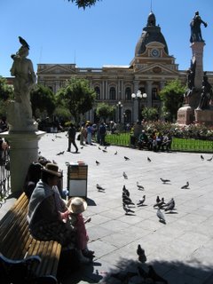
We headed back to Cocacabana and boarded a bus bound for the capital La Paz. La Paz is an amazing city; Its setting is hard to believe. We arrived from the west in the suburb Altai that fringes the top of the canyon La Paz is set in. From there the view of La Paz stretched out far below with downtown set smack in the bottom and then endless redbrick building climbing way up all the steep slopes that lead away from it. Towering over the city and visible from almost everywhere is the ominous triple peaked glaciated massif of Ilimani at 6554m the second tallest in Bolivia. Aside from the incredible
 setting the city is rich in culture, the most indigenous of any capital in the Americas. Its market is well... It is a market; the entire city is lined with streets selling everthing imaginable from fruit and vegetables to antique stoves and dried llama fetuses. The latter is only found in the spooky witches market aswell as other haunted looking things like dried armadillos and other dried or preserved animals or parts of animals. I´ve never seen a city so bustlin and hectic but at the same time the business and university area are totally tranquilo (tranquil).
It was soon time to set ourselves upon a proper adventure. We enjoyed the big city life for a few days and then set off towards the mountains still with our american friends to a village called Sorata. At a much more comfortable 2679m Sorata lies below the Altiplano on route towards the Amazon in an very pleasent green but mountanous area known as the Yungas. This was the starting base for all treks and climbs in the majestic mountains we had seen from lake Titicaca. We had made plans to climb a 5910m peak named Pico Scholtze not of extreme dificulty. We went to a guide to make some inquieres about the climb but were somehow convinced to attempt the ambitious Jakouma at 6427m the highest in the area and third tallest in Bolivia.
We hired two porters to help us carry our gear aswell help us find our way to base camp. The plan was three days up to high camp at 5457m then to climb it and return that and the next day to Sorata. Unfortunately I ate a bad $.17 street hamburger the night before that left me with some pretty bad diarhea for the whole trip. Our first day the terrain was not d
 ificult so we had two mules help pack up gear and from there it was us with the help of our porters. The rainy season was just beggining in Bolivia and for the first two days it rained and misted non stop which was very discouraging; if we were going to summit this peak we needed good weather. We had second camp all to ourselves at Laguna Glaciar a miserable wet little spot until on the third morning the skys cleared and an inspiring view surrounded us. It was very easy to see why this mountain range had been compared to both the Alps and the Himalayas. From our camp we could clearly see Llampu 6357m the second tallest in the area and possibly the most dificult in Bolivia. Its West face was a terrifying pitch covered in chopped up and precariously hanging glaciers and steep rock, it looked definition Himalayan. Soon after that clearing the sky again turned miserable and we trudged through snow and sleat up to high camp on the glacier. The porters left us there with vague directions of the route up and then returned to the lake rather than camp needlessly on the glacier. Very unfortunately they had forgotten the topo map that we were going to borrow although we should have made sure they had it. By this altitude at 5450m we were moving very slow, setting up the tent was a very laborous task demanding that we rest frequently.
IN the evening the sky cleared up and we scrambled up from camp to the the top of peak 5573 where we got a good view of the route ahead. Also we were rewarded with a view of Lago Titicaca and the actual island from which we saw these mountains. First we whould have to gain 500m by zigzagging through a very heavily crevassed glacier that had atleast one route that looked realistic. Then we would be near the bottom of the summit hill another 500m up that we could not decipher exactly what to do with. We decided that the key would be a very early alpine start so we set the alarm for 1:30 AM and planned to be hiking by 2 AM.
I woke up an hour before the alarm sounded and was full of energy and excitement. We got up just before the alarm and donned our ice axes and climbing equipment. At this hour of the morning travel on glacier is far safer than in the day; all the snow that is hiding crevasses and other hidden dangers is frozen solid and trustworthy. We snaked our way up the glacier by headlamp with great help from a halfmoon and a clear night sky. Some of the crevasses near the top section were of epic sizes. I shined my light down one but no bottom was visible it looked as if it could swallow an entire smaller mountain hole. Clouds were coming and going but visibility was generally pretty good. We began to traverse to the right below the summit hill towards a spur that would hopefully get us up onto the west ridge. We reached it and were about to try acsending it when thick clouds swept in ruining our visiblity. At this time light was begining to show in the horizon. We began to reconsider as we were both already exhausted from the altitude at 6000m and were not sure of the route. We paused and tryed to eat a snack and drink some water but our water was half frozen and hunger is very minimal at high altitude.
We agreed to abandon our summit attempt and go down while popping up to the top of a smaller mountain along the way. Soon after the sky cleared and light from the horizon made crystal clear visbility. Immidiately the route was obvious: through the pass to the right and then around and up the South face. Still having known the route we would be another 3 1/2 hours to the summit and then be descending the treacherous glacier warmed by the sun. We were happy with the beautiful scenery and having reached higher than ever before and we descended down on the still frozen glacier. We were exhausted and immidiately I passed out in the tent. I woke up two hours later to extruciating heat. The sun was blasting through the tent amplified by all the glacier around and I was wrapped up in warm clothes and my sleeping bag. I wearily pulled off all the clothing right down to my shorts and flopped out the tents opening. I was extremely dehydrated so I went straight for where my waterbottle lay which was now not so frozen and guzzled the whole liter down. The sun outside was even worse but the temperature more reasonable. I couldnt even open my eyes until I fumbled my sunglasses out of my pack and then I went over to where I left the other water bottle and started chugging its semi-frozen contents down. I went back in the tent to get out of the direct sun but it was abnormably hot. Still I had no choice so I curled up under my jacket as much away from the sun as possible and tried to rehydrate. We both felt like shit especially me but we had no choice to slowly pack up and get the hell off the glacier. Packing up was painful and weary but we plled it off and went to meet our porters.
Alredy at the lake with 500 m less elevation I felt considerably better. The porters had heard on the radio a snow storm was moving in that night so we continued down to a lower camp. We ended up continuing farther and farther down and then decided to go right to Sorata. An exhausting day, aside from climbing the mountain starting at 2 AM we descended over 3000m down to town at 5PM. Back in town we each oredered a pizza and tacos with cold beer. Glad to be down. We didn´t make the summit but we still had an excelent trek and saw spectacular scenery from higher than wed ever been.
After that we went back to La Paz and took a day to chill. We wernt sure what to do with ourselves so we decided to sign up to mountain bike the infamous death road. The road from La Paz high on the plain down to Corioco near the Amazon lowlands is statistically the most dangerous road in the world with over 100 fatalities annually. It has become a popular tourist activity with several different companies offering transportation, bike, clothing, and food for between 35 and 75 $ mostly depending on the bike.
We signed up for the cheapest and early in the morning were transported with 8 others up to a pass called La Cumbre at 4600m. From there we saddled up and cruised down a long concrete
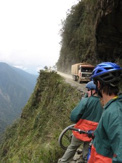 road for over an hour. The scenery was spectacular and the odd section went off road but it hardly seemed that dangerous. Because the old vehicules here cant handle the big hills the grade was nothing compared to the average steep grade that I was used to riding across Canada and the top speed was around 45km. All of a sudden the road ended with a barricade, surely that wasn´t it I thought but the guide pointed down to teh right of the barricade. From there a steep gravel path dived down the mountain side. Que Bueno!! This is where the death road began. This led onto a three hour ride of Cliffclinging single lane road around tight hairpin turns that supplied no protection or barricade should your momentum vere off course. Every while there was a widened part where vehicules could pass by each other.
We sat from a vantage point watching the road below as two buses one from each direction bore down on eachother and for a moment it looked like we were going to witness something terrible as the came around a blind corner just in time to slam on the brakes and negotiate by eachother. Some corners had people waiting hoping for a coin or two with red flags green flags to signal when blind corners were safe to continue. Its amazing the array of jobs you find in the developing world, anything to make a few coins. Other blind corners you just had to be damn cautious. We took off down the steep winding death road with me and Sam and the guide leading way ahead of the pack. Adrenalin surged as we rocketed into tight hairpin turns, our bikes had thick nobby tires that gripped the road aslong as we could keep hold of the jittering handlebars due to the poor suspension. Down and down we flew for hours on the seemingly endless hill as the climate and forest changed continuosly. The hill was enormous. My biggest climbs or downhills biking across Canada had been around 850m while this hill dropped 3500m. Finally hours later we arrived at the bottom covered in mud and dust and thirsty for beer. That was definetly one of the funnest days of the trip and very much worth the money.
Lago Titicaca





Sorata and Jakouma trek


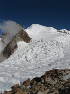

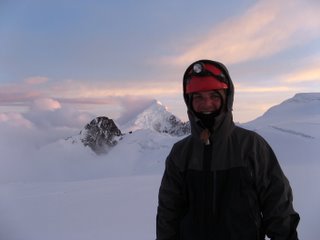
Peak 5573 (as part of Jakouma trek)


